Please use BACK BUTTON ON BROWSER to return to main list
OLD 1860 COLOR MAP OF BRAZIL ARGENTINA PARAGUAY URUGRAY
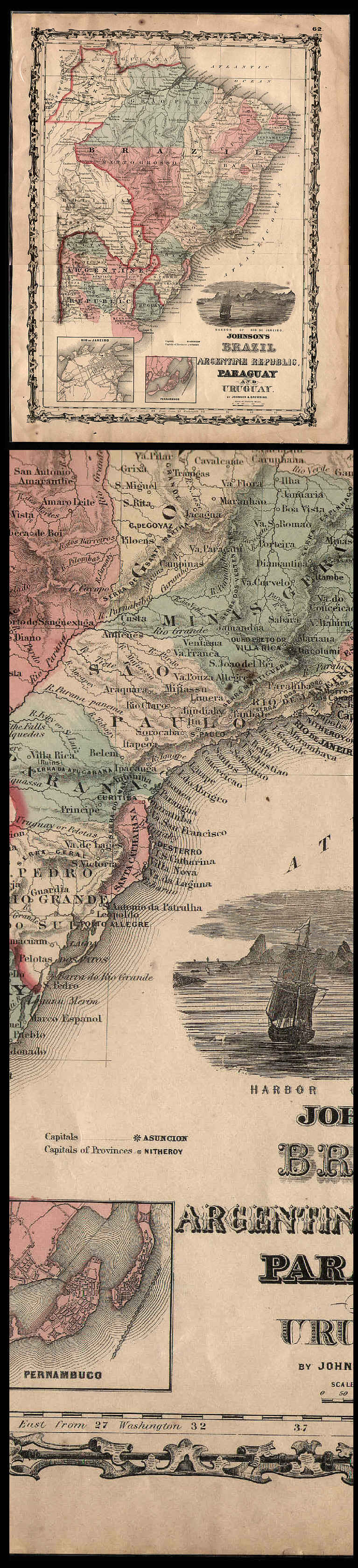
This is a fine old map about 14.5 x 18" neatly removed from an 1860 atlas published by Johnson & Browning in Richmond, Virginia. The states / provinces of each country are colored in with green, pink, & yellow, and the countries are outlined in darker red. A complete description of this map follows:
Johnson's BRAZIL, ARGENTINA REPUBLIC, PARAGUAY AND URUGRAY by Johnson & Browning, with two inset maps: Rio de Janeiro & Pernambuco, and engraving of the Harbor of Rio de Janeiro. Page No. 62 as published in:
JOHNSON'S NEW ILLUSTRATED (STEEL PLATE) FAMILY ATLAS, With Descriptions, Geographical, Statistical, And Historical. Compiled, Drawn, and Engraved Under The Supervision Of J.H. Colton And A.J. Johnson. Published by Johnson And Browning, Formerly (Successors To J.H. Colton And Company,) Tenth Street (Second Door from Main), RICHMOND, VIRGINIA, 1860. Entered ... One Thousand Eight Hundred and Sixty, by Johnson & Browning ... Virginia. Printed by Charles H. Wynne, 94 Main Street, Richmond, VA.
Map has a few light stains & spots, and some wear, chips & small tears around the edges, but is otherwise in quite good condition on paper of fine old rag content as shown in scan. The reverse side is blank. This map would be quite displayable if matted and framed. Scan is made with the map INSIDE its protective plastic sleeve. Scan shows the full size map & enlarged detail.
Price= $45.00
Please use BACK BUTTON ON BROWSER to return to main list
ORDERING
INFORMATION
BACK TO HISTORY BROKER HOMEPAGE